Case: Aerial Mapping
Elective Science Course
As part of work in AP Environmental Science, high school students
at a rural boarding school used low-cost aerial mapping
tools (cameras suspended from balloons or kites) to answer
questions about their school and the surrounding area. Working
with a curriculum co-developed by a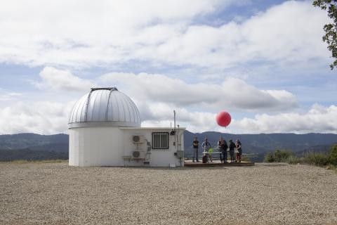 CCS researcher
and their AP environmental science teacher, each group developed
questions, identified research sites, and assembled
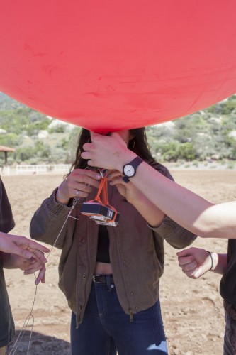
balloon-mounted cameras using open source plans available at the
Public Laboratory for Open Technology and Science (Public Lab).
They produced research notes detailing methods and findings, and
published them to the Public Lab online community, and to members
of the school community. The project created opportunities for
critical thinking about local issues, pushed the students to
think creatively about the technical challenges of obtaining
useful aerial images, and challenged them to stay organized as
they grappled with unfamiliar techniques on a fairly tight
timeline.
CCS researcher
and their AP environmental science teacher, each group developed
questions, identified research sites, and assembled
balloon-mounted cameras using open source plans available at the
Public Laboratory for Open Technology and Science (Public Lab).
They produced research notes detailing methods and findings, and
published them to the Public Lab online community, and to members
of the school community. The project created opportunities for
critical thinking about local issues, pushed the students to
think creatively about the technical challenges of obtaining
useful aerial images, and challenged them to stay organized as
they grappled with unfamiliar techniques on a fairly tight
timeline.
Species or system studied: Varied – Student-driven
Research questions were elicited from school community or developed from student interests and experiences. Topics included habitat mapping, thermal properties of rooftops and paved surfaces, and water management.
Research site: rural boarding school
The school campus includes more than 400 acres, adjacent to a national forest, and farmland. Aerial mapping investigations included the health and functionality of vegetation in a bioswale, a survey of dormitory rooftops, and examination of variation in habitats.
Participants: high school students
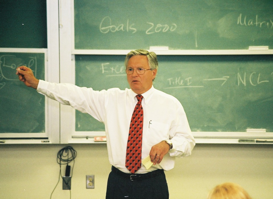
Thirty-three 11th and 12th graders in 3 sections of an AP Environmental Science class. The class was joined by a UC Davis researcher and visited by an experienced aerial mapper.
Structure: classroom-based
In the boarding school setting there were opportunities for students to work during class time, and to conduct research outside of class. The project used aerial mapping techniques and online resources, building on methods of Public Lab (publiclab.org). Audiences for individual projects were locally-based: the school’s environmental action committee and facilities department were the primary clients.
Duration: 3 weeks
The project filled the last 3 weeks of the academic year, directly following the AP exam. Each week consisted of three 50-minute sessions, and an 80-minute “lab period.”
Institution: rural boarding school
The project took place at a boarding school of about 250 students in a small town in Southern California. The small, tight-knit community emphasizes connection with the outdoors, and students enjoy close relationships with faculty.
Other activities:
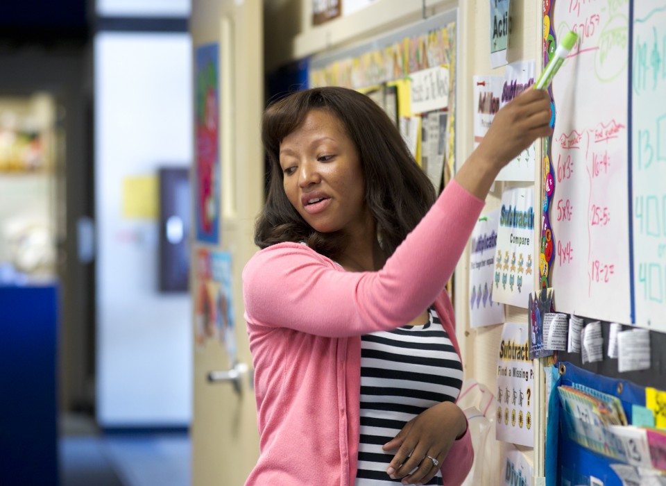
Students had spent the year developing observations about local flora and fauna in a research notebook and some drew on this work for their aerial mapping project. Some students were also engaged to varying degrees in environmental and outdoor activities, such as sustainability council, environmental action committee, and the camping and horse programs. These provided context for the project.
Curricula resources:
- Coming soon

Contact:
To learn more about aerial mapping, visit publiclab.org, and see
also this
blog post for insights on aerial mapping in an
educational context.
For more information about this project, contact Ryan Meyer.
Key Practices In Action:
Through in-depth case studies of diverse YCCS projects, we have documented youth-centered key practices that are effective in promoting learning and environmental science agency. Click the headers below to learn more about what those key practices look like in this particular case.
Sharing Findings with Outside Audiences
Linking research to community interests motivates the work, but sets a high bar.
Instructors spent time in the lead-up to the project polling community members for their ideas, and translating these into a menu of projects that students could choose from. Some groups took these prompts seriously, forming their project around the stated need and interacting with community members as they developed and wrote up their findings. Other groups focused more on the challenge of conducting a successful flight and analyzing the resulting data, and did not engage as meaningfully with the community’s questions. However, the short time frame made it difficult to structure interaction with key audiences and follow up on student findings and recommendations.
Each group also contributed one or more research notes to Public Lab’s online community of practice, where people all over the world share their experiences using aerial mapping techniques. This venue required students to articulate their methods and findings within the community’s scientific norms, widened the scope of potential contribution beyond the specifics of their results, and set a tone of creativity and tinkering in science. For example, one group sought guidance on the Public Lab website on how to conduct flights using a smartphone camera, as opposed to the standard point-and-shoot. Finding very little, they developed their own approach to constructing a durable and stable rig. They developed a standalone research note about their engineering feat, and posted it on the Public Lab site.
Ensuring High Data Quality
Students develop their own internal data quality standards, learn from their mistakes, and iterate.
Students grappled with the challenge of generating good quality aerial images that could speak to their research question. For many, this meant making and then learning from mistakes. This was especially true given the limited time available to learn about and discuss these issues before diving into the projects. Issues such as flying conditions, camera settings, and the interrelationship of camera resolution, field of view, and height, all impacted the students’ results. After each flight, students downloaded their images and examined them to determine what had worked, and what hadn’t. They applied these lessons to one or more follow-on flights. Instructors were available to participate as needed, but the students were encouraged to navigate these challenges within their groups.
Projects varied widely in terms of the information needed in order to get good results, and the feasibility of the chosen methods. This meant that there was no single external standard for data quality that the students could look to, nor did the projects identify external technical experts who would actively evaluate or use the student-generated data. This gave students the opportunity to take ultimate responsibility for developing data quality stands, but also meant that there was no obvious pathway for external validation that students could directly follow or learn from.
Interacting with Complex Social Ecological Systems
A new perspective leads students to develop new questions about their community.
The aerial mapping projects very literally gave students a new perspective on their community and local environment. Many students became absorbed in careful scrutiny of images that gave them an unfamiliar view of familiar places. This often led to broader reflection about a variety of issues and, in some cases, deepened awareness of interactions between natural and built environments. One group became interested in the role that rooftops play in issues such as building safety, insulation and energy efficiency, and community aesthetics. They interviewed the director of facilities to better understand what they were seeing in their images. Another group attempted to determine the efficacy of a bioswale, constructed several years ago in a local pasture. They became interested in the general problems of erosion, drainage, and water contamination, and gained a new appreciation for the need to address these issues on campus.
YCCS Products
Research Notes. Online research notes with introduction, methods, results, and discussion, including photos annotated and/or stitched together to create digital maps.
Why: Inform members of the boarding school community about issues of concern or interest, and ideally, support better environmental practices.
Why: Contribute to ongoing discussion about effective aerial mapping techniques and their application in a range of contexts.
Audience: School community members such as the facilities director, sustainability council, and environmental action committee.
Audience: Teaching staff interested in developing coursework that speaks more directly to local community issues.
Audience: Public Lab online community, and Public Lab staff.
Impact: Some projects can be revisited by future student groups, to create a long-term data set.
Impact: Within 6 months, research notes had received collectively more than 1200 views, and some had been “starred,” indicating that Public Lab community members intended to follow the discussion.
Impact: Teachers at the school will offer an aerial mapping elective (outside the AP Environmental Science class) to continue developing the curriculum.
Outcomes & Evaluations
The instructors elicited feedback from students in an online survey.
Public Lab provides tools for tracking interest in and appreciation for individual research notes. Students and educators see page views, the number of people tracking discussion of their posts, and “stars” (similar to “likes” on social media).