Project Update: A Year of Listening and Learning about Wildfire in Tuolumne County
 Wildfire touches just about every
corner of life in the Sierra Foothills. Whatever your profession,
wherever you and your family live, the risk of wildfire, and the
many institutions and processes that have emerged to deal with
it, are bound to play a role in daily life. These realities were
reinforced to our team over the last year, as we embarked on the
4-year, CALFIRE-funded Tuolumne Community-Based Fire Resilience
Project.
Wildfire touches just about every
corner of life in the Sierra Foothills. Whatever your profession,
wherever you and your family live, the risk of wildfire, and the
many institutions and processes that have emerged to deal with
it, are bound to play a role in daily life. These realities were
reinforced to our team over the last year, as we embarked on the
4-year, CALFIRE-funded Tuolumne Community-Based Fire Resilience
Project.
The ultimate goal of this project is to learn how communities can make use of wildfire planning tools. Many tools (of many different kinds) have been developed to support reducing fire risk. But there is often a gap between the efforts to develop the tools – often driven by, for example, scientists, consultants or government agencies – and bottom-up needs, priorities, and capacities of communities. As social scientists have found time and time again, there are many different factors that might make a tool useful in dealing with a complex problem, and it’s hard to know what those will be without collaborative, user-focused efforts to understand the local context of use.
This meant that before we could even decide which tools should be tested with communities in Tuolumne County, we had to start building relationships, and understanding the local context from as many perspectives as possible.
Listening to Fire Influencers
Throughout the first year of this project we have been meeting – usually in-person – with people that deal with fire in their lives and careers, and who are working on making Tuolumne County more resilient to wildfire. Some of these “Fire Influencers,” as we’ve come to call them, are obvious choices: FireSafe Council members, CALFIRE and local Fire District employees, local government officials, and staff of the Resources Conservation District. But wildfire touches almost every aspect of life in Tuolumne County. Many folks who, in other parts of the world, might not be expected to think about wildfire are, in this context, highly engaged and knowledgeable. We’ve heard from realtors, insurance brokers, outdoor school directors, ranchers, loggers, and land trust staff, just to name a few.
Meeting in-person is a great way to build relationships, and at times it also affords an opportunity to get out on the land, and understand problems in a deeper way. For example, one meeting that started at a picnic table in a park ended up on a local hillside where only a few days before, a firebreak and a homeowner’s defensible space had been instrumental in halting the progress of wildfire that came within just a few feet of the home. We are extremely grateful to everyone who spent time with us!
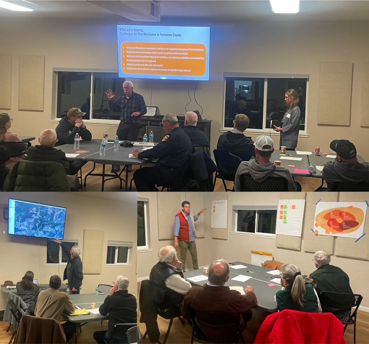
Reflecting on what we’ve heard
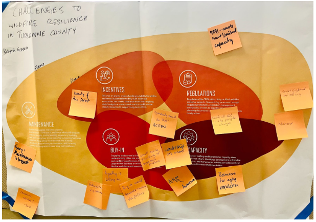 The listening stage comes first,
but it never truly ends. As we gather more perspectives, and
ideas about the tool development and testing process, we need to
keep listening and learning from our local partners. In February
we held a meeting in Twain Harte, to present a synthesis of what
we’ve been hearing, along with our ideas about next steps.
The listening stage comes first,
but it never truly ends. As we gather more perspectives, and
ideas about the tool development and testing process, we need to
keep listening and learning from our local partners. In February
we held a meeting in Twain Harte, to present a synthesis of what
we’ve been hearing, along with our ideas about next steps.
The group brainstormed and gave feedback on what we’ve been hearing and learning, and on ideas for testing out tools.
Next Steps:
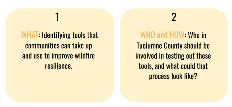
We’re now at the early stages of identifying and testing wildfire resilience tools. First up is a visualization tool for understanding how properties will look after vegetation thinning. Using artificial intelligence, 360-degree photos can be edited relatively quickly to help property owners understand what a place will look like after a fuel reduction treatment.
Watch this space for more updates on that process, and other news from the project!