Examining the Role of Community and Citizen Science in Marine Protected Areas
The UC Davis Center for Community and Citizen Science is launching a project aimed at understanding the contributions of CCS programs to the first decade of MPA implementation, which can inform the 2022 decadal review of California MPAs, and subsequent planning and implementation. We are working with state partners, including the California Ocean Protection Council and Department of Fish and Wildlife, and CCS practitioners and participants to assemble data and develop insights that cut across the many different projects that have contributed to MPAs over the last 10 years.
Subscribe to the Project Newsletter (Select the Marine and Coastal Citizen Science Interest)
Map of California’s Marine Protected Areas and MPA Citizen Science Organizations
Launch
Interactive Map
Launch Interactive Map (Mobile Version)
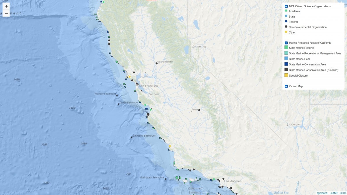
Data Sources: UC Davis Center for Community and Citizen
Science; State of California Department of Fish and
Wildlife, Marine Region GIS Lab; Google Earth Satellite Imagery
Project Scope
146 Marine Protected Areas
61 State Marine Conservation Areas
50 State Marine Reserves
14 Special Closures
10 State Marine Conservation Areas (No-Take)
6 State Marine Parks
5 State Marine Recreational Management Areas
Preliminary Inventory
A preliminary search for CCS projects doing work in or related to California MPAs yielded the following data. We will be updating these figures periodically as the project evolves.